


Climbing Mt Dana in Yosemite
With the Hwy 120 (Tioga Road) closed on Monday October 5 and blocking the way home, I resolved to test whether my two-year-old knee injury to both the anterior and posterior cruciate ligaments had improved. That’s a little nutty under the winter conditions, but I figured if I could make it up (and down) Mt Dana then I’d have some confidence that my knee was in reasonable condition.
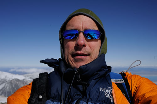
Not being completely crazy, I took my SPOT beacon, visible in orange at lower right, busy transmitting an “all OK” message. More on SPOT.
Click the image below to see field-of-view examples from the Zeiss ZF 21/25/28/35/50/100 lenses (sorry, no ZF/ZE 18mm, gear was already 25 pounds or so, I would have had to also take the ZE 18/3.5 and the crappy Canon 5D Mark II, I don’t own the ZF 18/3.5). All shots handheld in a hurry, as I was getting sweaty-cold.

Mt Dana is a 13,061 foot peak. The trailhead is right at the Tioga Pass entrance station (east side of Yosemite), at just under 10,000 feet elevation. I had last climbed Mt Dana on October 15, 2007, on a beautiful and relatively warm October day.
Leaving at ~ 7:30 am, the temperature was a crisp 9° F (-12° C). I hoped for a warmer summit, but it proved frigid. With sweat-soaked clothes at the summit, I quickly donned a down vest and windproof jacket over and above my other clothing. I had little enthusiasm for photography at that point, and getting cold while alone and 3000 feet up is not a good plan, so I stayed only briefly at the summit.
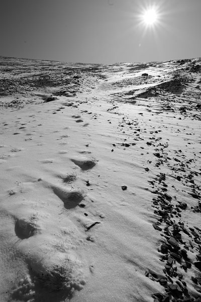
The fresh snow was powder-dry and easy going at lower elevations. And I was really disappointed to find the trail already tracked— was I not the first that day? My disappointment turned to delight as I realized the tracks were those of a large black bear, which does shit in the woods. These tracks are about 10" long! I observed numerous other tracks right up to the summit (Pika).

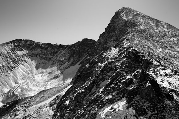
It’s darn hard to take interesting photos on summit climbs. But I captured some which I think are interesting, at least to anyone who likes this sort of thing. These shots all used the Nikon D3x and Zeiss ZF 21/2.8 Distagon, a fabulous lens. Shooting the Canon 5D Mark II was not in the cards, even though it’s significantly lighter. It would not have handled the contrast, and its images in harsh lighting are just plain ugly.
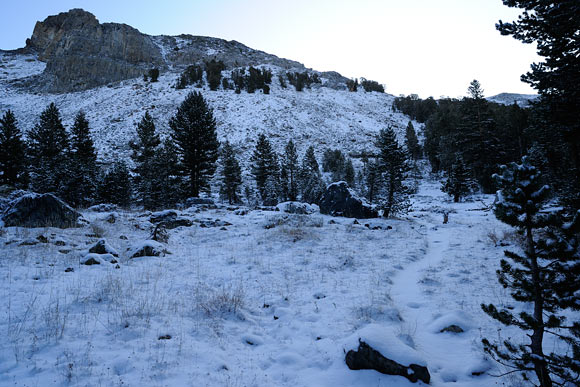
Shown below is the trail shortly after leaving the trailhead. Puffy light snow was a delight at first. Most of this snow once exposed to the sun did melt by 5pm, but most of it in the shade did not. It rose to a balmy 37° F by 4pm.
Wear sunscreen (I foolishly did not). The sun fries you frontally and from reflection off the snow— a double dose. Going up here wasn’t too bad, but still required great care.
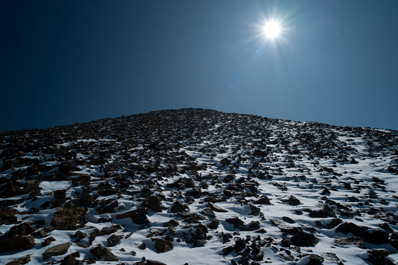
This might look easy, but it still required care with rocks to slip on at every step.
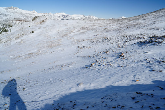
This stuff below was really difficult— every time I put a foot down, a new surprise lay under the snow. Very slow going, literally feeling with the foot each and every step whether it was safe to bear weight. Then the terrain steepened and became more difficult, with deeper snow. Once in a while I found the “trail” but all that meant was that the snow had drifted to 10-16 inches deep.
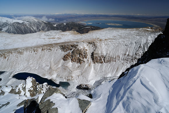
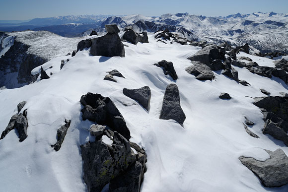
Shown below, the Dana summit is visible, still a grunt to get there. The beautiful glacier-carved valley at left contains deep blue pools of ice water, so blue it’s almost black.
Mono Lake, nearly destroyed by years of taking too much incoming river water for Los Angeles lawns, is seen at top right in the image below.
Saddlebag Lake is see at top center, with Tioga Lake below and to the left.
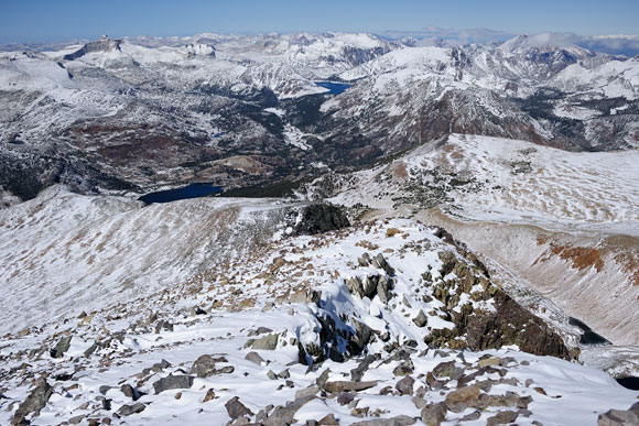
The summit provides an expansive view, worth spending a few hours if conditions allow. I did not sign the registry because I didn’t want to dig through the drifted snow. Ski runs at Mammoth are visible if one walks a bit further.
And my knee? I was delighted to find that it performed very well, a great relief, knowing that future adventures won’t be limited by a weak joint as much as I had feared.
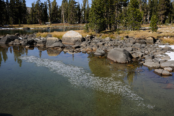
Snow doesn’t last with full sun in October, but ice lingers, portending winter— Lloyd